How to prepare canvassing campaign with Walk Lists
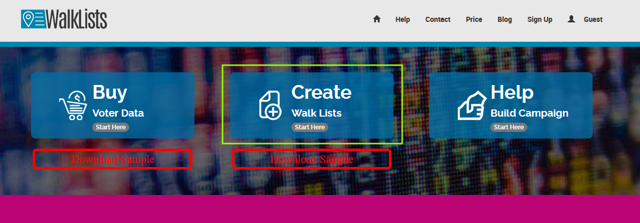
1. Go to the landing page of WalkLists and click in the area of "Create Walk Lists Start Here".
2. That opens another page where you can click to browse and select a file or drag and drop the file.
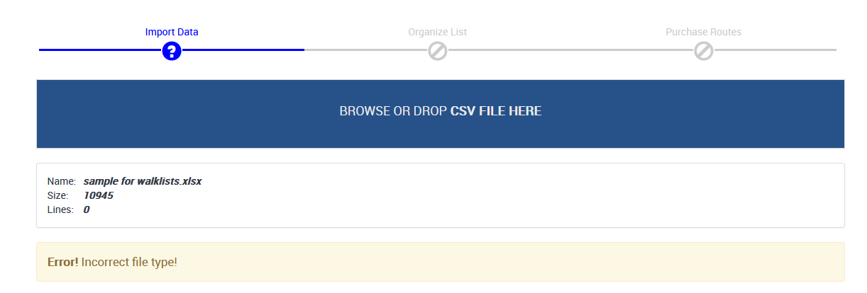
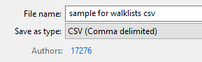
Keep in mind the file in question MUST be CSV file format, otherwise, you would see an Incorrect file type message. If your file type is excel or text format, you can save as CSV, comma delimited format
Important note: if your file has tens or hundreds of columns, that may be putting a heavy load on the system later when map calculations are done, so for simplicity, only keep columns that are relevant to your campaign, like up to 50, or 90,
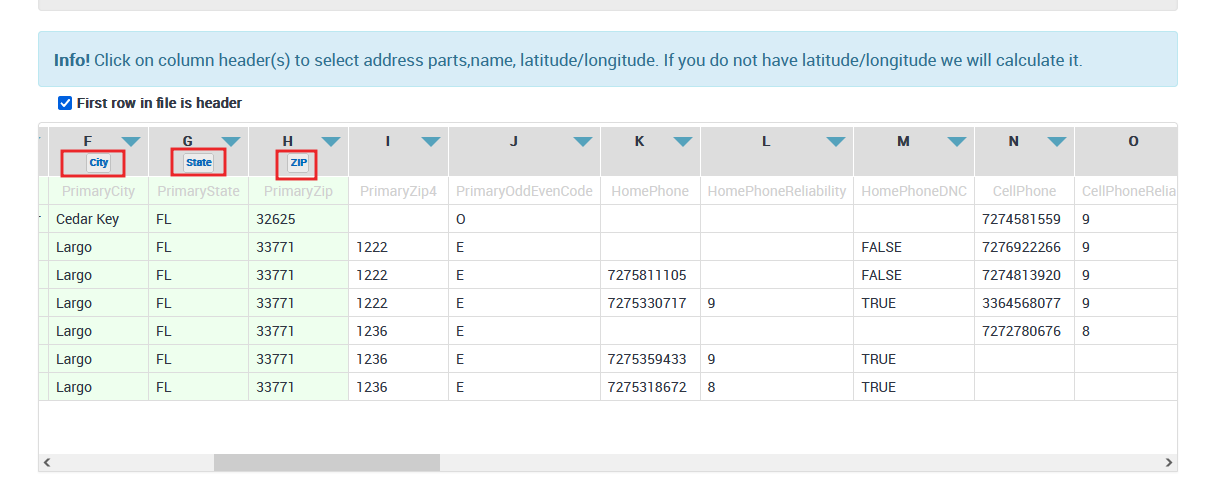
3. After the file is uploaded the system will present a few rows in a grid with predefined selections of the following:
First Name
Last name
Street Number
Street name
City
State
Zip Code
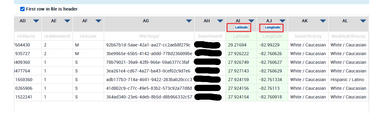
Latitude
Longitude
If the file does not have Latitude and Longitude data, no worry, we have you covered. Scale Campaign has geocoding service called CSV2GEO that automatically will insert the needed latitude and longitude coordinates after payment is completed.
In the example, the system had selected automatically the first column but after carefully manually examination, we can see that that column is not the first name column.
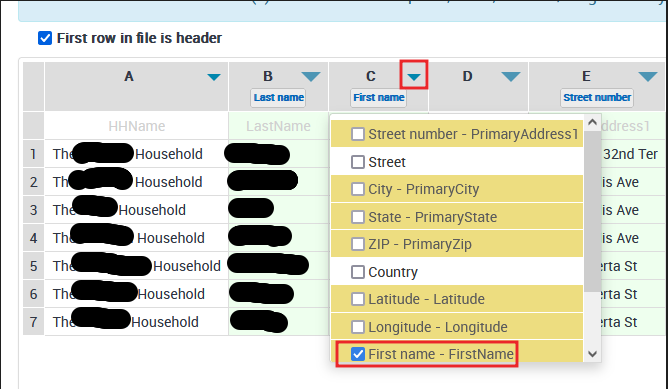
To correct it, we redo it by unselecting from column A first name, then in column C, select the first name in the dropdown by clicking on the small arrow. If you continue to examine the other columns, often street numbers and street names are put together, but sometimes the system doe snot detects it. as in this example, the system only selected street number, but in the same column, the street name was present. to correct it, we simply add a street name to the same column.
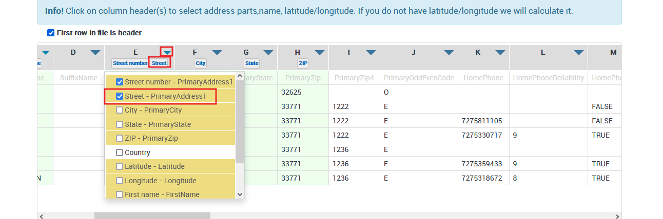
The rest of our sample looks ok from the point of preselecting tokens
4. Move to purchase route step
5. Any questions: Just send us an email at info (at) scale campaign dot com