Maximizing Canvassing Success: The Importance of Relevance in Creating Accurate Walklists with Walklists.com
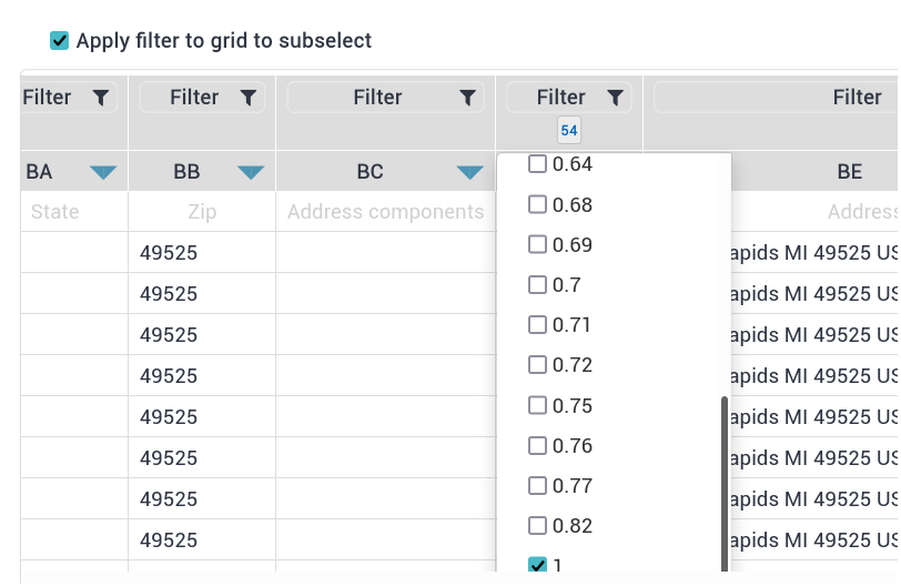
The relevance feature allows users to assign a relevance score to each address in their walklist. This score ranges from 0.00 to 1.00 and represents the accuracy of the address location. For example, an address with a relevance score of 1.00 would be a pinpoint location, while an address with a relevance score of 0.50 might be a general location such as a street or neighborhood.
By using this feature, users can filter their walklists based on relevance score, creating highly accurate lists that can greatly increase the success of their campaigns. For example, if a user is creating a walklist for a political campaign, they may want to filter out addresses with low relevance scores to ensure that they are only targeting likely voters in their district.
Walklists is the only platform that offers this relevance feature, giving users a significant advantage over other platforms. Other walklist creation platforms often lack the relevance feature, which can lead to inaccuracies in address locations. Without this feature, users may not know how accurate the address locations are, leading to potentially wasted time and resources.
In addition to the relevance feature, Walklists is also known for its ease of use. The platform has mobile apps available on both the Apple Store and Google Play, making it easy for users to access their walklists on the go. Users can also create and modify their walklists in real time, allowing them to quickly adjust their campaigns as needed.
Walklists also offer a variety of customization options to meet the specific needs of each user. Users can filter their walklists by relevance score, as mentioned earlier, but they can also filter by other factors such as address type, voter history, and more. With these options, users can create highly targeted walklists that are tailored to their specific campaign goals.
It's important to note that relevance scores are not always perfect. Geocoding, the process of converting addresses to geographic coordinates, can be complex and inaccurate at times. Walklists uses csv2geo.com, a geocoding tool that uses multiple sources to improve accuracy, but there may still be cases where the relevance score is not 100% accurate. That's why Walklists allows users to filter their walklists based on relevance score, so they can make informed decisions about which addresses to target.
Another advantage of Walklists is that it allows users to easily upload and manage their walklists. Users can upload their address lists as CSV or Excel files, and Walklists will automatically calculate the relevance score for each address. Alternatively, users can prepare their files with latitude, longitude, and relevance scores beforehand using csv2geo or another geocoding system.
Walklists also allow users to create multiple walklists for different purposes. For example, a political campaign may create one walklist for likely voters, another walklist for potential supporters, and a third walklist for undecided voters. This allows the campaign to target each group more effectively, increasing the chances of success.
In conclusion, the relevance feature offered by Walklists can greatly improve the accuracy of walklists for door-to-door canvassing. With the ability to assign a relevance score to each address, users can filter their lists and create highly accurate walklists that can greatly increase the success of their campaigns. In addition, Walklists' user-friendly mobile apps, available on both Apple Store and Google Play, make it easy for canvassers to access and navigate their optimized routes while in the field, further improving the accuracy and efficiency of their door-to-door canvassing efforts.
Related blog posts: How to prepare canvassing campaign with Walk Lists